
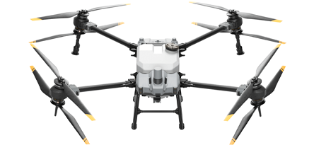
Crop Protection
Efficient & Autonomous Operation
Land Surveying
Payloads
Detect Every Detail

Mavic 3M
FlyCart 30
Related products
Take a Closer
Look
Look
Zenmuse S1
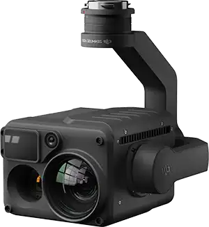
Zenmuse H20N
Zenmuse H20T
Zenmuse V1
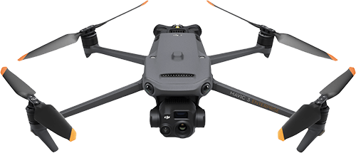
Mavic 3T
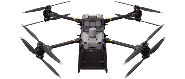
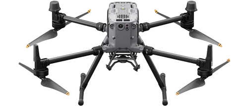
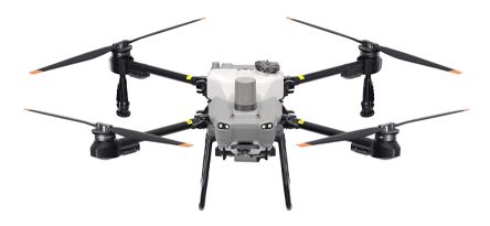
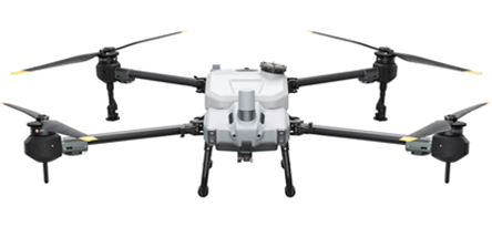
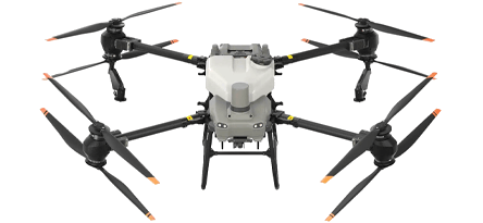
Matrice 350 RTK


NEW
NEW
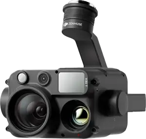
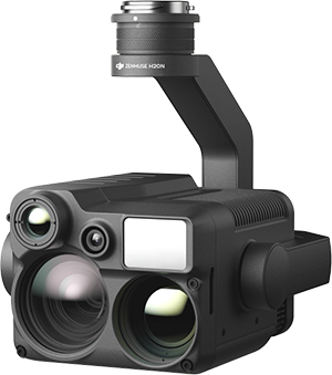
Zenmuse H30 Series
NEW
AGRAS T40
AGRAS T30
AGRAS T25
AGRAS T20P
AGRAS T10

AGRAS T50
TOP
TOP
Matrice 350 RTK Charger
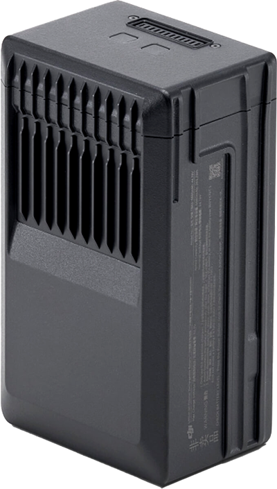
Matrice 350 RTK Battery
Mavic 3E Battery Kit

DB1560 Intelligent Flight Battery
WB37 Intelligent Battery
Trichogramma spreading system
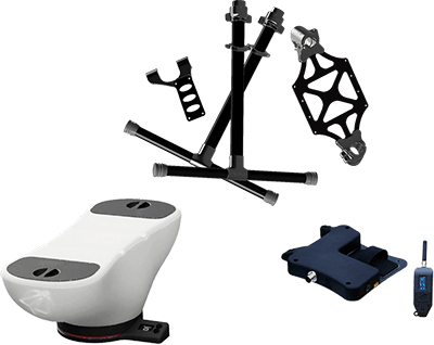
DB2000 Intelligent Flight Battery
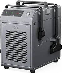
C10000 Intelligent Power Supply
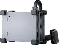
C8000 Intelligent Battery Station
DJI FlyCart 30 Winch System Kit

Specs
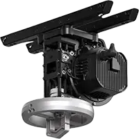
Aircraft
Dimensions (unfolded, without propellers)
810×670×430 mm (L×W×H)
Dimensions (folded, with propellers)
430×420×430 mm (L×W×H)
Diagonal Wheelbase
895 mm
Weight (with single downward gimbal)
Without batteries:
Approx. 3.77 kg
With two TB65 batteries:
Approx. 6.47 kg
Approx. 3.77 kg
With two TB65 batteries:
Approx. 6.47 kg
Single Gimbal Damper’s Max Payload
960 g
Max Takeoff Weight
9.2 kg
Operating Frequency
2.4000-2.4835 GHz
5.150-5.250 GHz (CE: 5.170-5.250 GHz)
5.725-5.850 GHz
In some countries and regions, the 5.1GHz and 5.8GHz frequency bands are prohibited, or the 5.1GHz frequency band is only allowed for indoor use. Please refer to local laws and regulations for more information.
5.150-5.250 GHz (CE: 5.170-5.250 GHz)
5.725-5.850 GHz
In some countries and regions, the 5.1GHz and 5.8GHz frequency bands are prohibited, or the 5.1GHz frequency band is only allowed for indoor use. Please refer to local laws and regulations for more information.
Transmitter Power (EIRP)
2.4000-2.4835 GHz:
< 33 dBm (FCC)
< 20 dBm (CE/SRRC/MIC)
5.150-5.250 GHz (CE: 5.170-5.250 GHz):
< 23 dBm (CE)
5.725-5.850 GHz:
< 33 dBm (FCC/SRRC)
< 14 dBm (CE)
< 33 dBm (FCC)
< 20 dBm (CE/SRRC/MIC)
5.150-5.250 GHz (CE: 5.170-5.250 GHz):
< 23 dBm (CE)
5.725-5.850 GHz:
< 33 dBm (FCC/SRRC)
< 14 dBm (CE)
Hovering Accuracy (with moderate or no wind)
Vertical:
±0.1 m (with vision positioning)
±0.5 m (with GNSS positioning)
±0.1 m (with RTK positioning)
Horizontal:
±0.3 m (with vision positioning)
±1.5 m (with GNSS positioning)
±0.1 m (with RTK positioning)
±0.1 m (with vision positioning)
±0.5 m (with GNSS positioning)
±0.1 m (with RTK positioning)
Horizontal:
±0.3 m (with vision positioning)
±1.5 m (with GNSS positioning)
±0.1 m (with RTK positioning)
RTK Positioning Accuracy (RTK FIX)
Pitch: 300°/s
Yaw: 100°/s
Yaw: 100°/s
Max Pitch Angle
30°
When in N mode and with the forward vision system enabled: 25°.
When in N mode and with the forward vision system enabled: 25°.
Max Ascent Speed
6 m/s
Max Descent Speed (vertical)
5 m/s
Max Tilted Descent Speed
7 m/s
Max Horizontal Speed
23 m/s
Max Flight Altitude
5000 m
When using the 2110s propellers and with the takeoff weight ≤ 7.4 kg.
7000 m
When using the 2112 High-Altitude Low-Noise Propellers and with the takeoff weight ≤ 7.2 kg.
When using the 2110s propellers and with the takeoff weight ≤ 7.4 kg.
7000 m
When using the 2112 High-Altitude Low-Noise Propellers and with the takeoff weight ≤ 7.2 kg.
Max Wind Speed Resistance
12 m/s
Max Flight Time
55 minutes
Measured with Matrice 350 RTK flying at approximately 8 m/s without payloads in a windless environment until the battery level reached 0%. Data is for reference only. Actual usage time may vary depending on the flight mode, accessories, and environment. Please pay attention to reminders in the app.
Measured with Matrice 350 RTK flying at approximately 8 m/s without payloads in a windless environment until the battery level reached 0%. Data is for reference only. Actual usage time may vary depending on the flight mode, accessories, and environment. Please pay attention to reminders in the app.
Supported DJI Gimbals
Zenmuse H20, Zenmuse H20T, Zenmuse H20N, Zenmuse P1, and Zenmuse L1
Third-Party Payload
Supports only certified payloads developed based on DJI Payload SDK.
Supported Gimbal Configurations
Single downward gimbal
Single upward gimbal
Dual downward gimbals
Single downward gimbal + single upward gimbal
Dual downward gimbals + single upward gimbal
Single upward gimbal
Dual downward gimbals
Single downward gimbal + single upward gimbal
Dual downward gimbals + single upward gimbal
Ingress Protection Rating
IP55
The IP rating is not permanently effective and may decrease due to product wear and tear.
The IP rating is not permanently effective and may decrease due to product wear and tear.
Global Navigation Satellite System
GPS + GLONASS + BeiDou + Galileo
Operating Temperature
-20° to 50° C (-4° to 122° F)
Remote Controller
Screen
7.02-inch LCD touchscreen; resolution: 1920×1200; max brightness: 1200 nits
Capacity
5880 mAh
Voltage
44.76 V
Type
Li-ion
Energy
263.2 Wh
Weight
Approx. 1.35 kg
Operating Temperature
-20° to 50° C (-4° to 122° F)
Ideal Storage Temperature
22° to 30° C (71.6° to 86° F)
Charging Temperature
-20° to 40° C (-4° to 104° F)
When the ambient temperature is below 5° C (41° F), the battery will trigger the auto-heating function. Charging at low temperatures may reduce battery life. It is recommended to charge at 15° to 35° C (59° to 95° F).
When the ambient temperature is below 5° C (41° F), the battery will trigger the auto-heating function. Charging at low temperatures may reduce battery life. It is recommended to charge at 15° to 35° C (59° to 95° F).
Charging Time
With a 220V power supply, it takes approximately 60 minutes to fully charge two TB65 Intelligent Flight Batteries and approximately 30 minutes to charge them from 20% to 90%.
With a 110V power supply, it takes approximately 70 minutes to fully charge two TB65 Intelligent Flight Batteries and approximately 40 minutes to charge them from 20% to 90%.
With a 110V power supply, it takes approximately 70 minutes to fully charge two TB65 Intelligent Flight Batteries and approximately 40 minutes to charge them from 20% to 90%.
Vision System
Obstacle Sensing Range
Forward/Backward/Left/Right: 0.7-40 m
Upward/Downward: 0.6-30 m
Upward/Downward: 0.6-30 m
FOV
Forward/Backward/Downward: 65° (horizontal), 50° (vertical)
Left/Right/Upward: 75° (horizontal), 60° (vertical)
Left/Right/Upward: 75° (horizontal), 60° (vertical)
Operating Environment
Surfaces with discernible patterns and adequate lighting (lux > 15)
Infrared Sensing System
Obstacle Sensing Range
0.1-8 m
FOV
30° (±15°)
Operating Environment
Large, diffuse, and reflective obstacles (reflectivity > 10%)
LED Auxiliary Light
Effective Illumination Distance
5 m
llumination Type
60 Hz, solid glow
FPV Camera
Resolution
1080p
FOV
142°
Frame Rate
30fps
Intelligent Flight Battery
Model
TB65
Capacity
5880 mAh
Voltage
44.76 V
Type
Li-ion
Energy
263.2 Wh
Weight
Approx. 1.35 kg
Operating Temperature
-20° to 50° C (-4° to 122° F)
Ideal Storage Temperature
22° to 30° C (71.6° to 86° F)
Charging Temperature
-20° to 40° C (-4° to 104° F)
When the ambient temperature is below 5° C (41° F), the battery will trigger the auto-heating function. Charging at low temperatures may reduce battery life. It is recommended to charge at 15° to 35° C (59° to 95° F).
When the ambient temperature is below 5° C (41° F), the battery will trigger the auto-heating function. Charging at low temperatures may reduce battery life. It is recommended to charge at 15° to 35° C (59° to 95° F).
Charging Time
With a 220V power supply, it takes approximately 60 minutes to fully charge two TB65 Intelligent Flight Batteries and approximately 30 minutes to charge them from 20% to 90%.
With a 110V power supply, it takes approximately 70 minutes to fully charge two TB65 Intelligent Flight Batteries and approximately 40 minutes to charge them from 20% to 90%.
With a 110V power supply, it takes approximately 70 minutes to fully charge two TB65 Intelligent Flight Batteries and approximately 40 minutes to charge them from 20% to 90%.
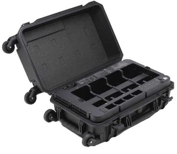
Intelligent Battery Station
Dimensions
580×358×254 mm (L×W×H)
Net Weight
Approx. 8.98 kg
Compatible Stored Items
Eight TB65 Intelligent Flight Batteries
Four WB37 Intelligent Batteries
Four WB37 Intelligent Batteries
Input Voltage
100-120 VAC, 50-60 Hz
220-240 VAC, 50-60 Hz
220-240 VAC, 50-60 Hz
Max Input Power
1070 W
Output Power
100-120 V: 750 W
220-240 V: 992 W
220-240 V: 992 W
Operating Temperature
335.5 g
Notes
The terms HDMI, HDMI High-Definition Multimedia Interface, HDMI Trade dress and the HDMI Logos are trademarks or registered trademarks of HDMI Licensing Administrator, Inc.
© 2023-2026, SYSTEMEX Sp. z o.o. - all rights reserved
SYSTEMEX Sp. z o.o.
ul. Grzybowska 80/82/700
00-844 Warszawa, Polska / Poland
ul. Grzybowska 80/82/700
00-844 Warszawa, Polska / Poland
NIP / VAT ID PL5273062037,
KRS: 0001042475
KRS: 0001042475
+48 694 694 843
info@systemex.pl
Your order