
Crop Protection
Efficient & Autonomous Operation
Land Surveying
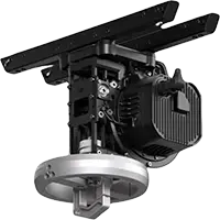
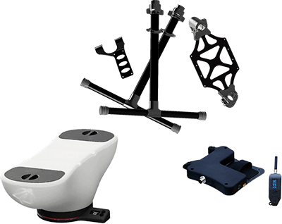
Payloads
Detect Every Detail

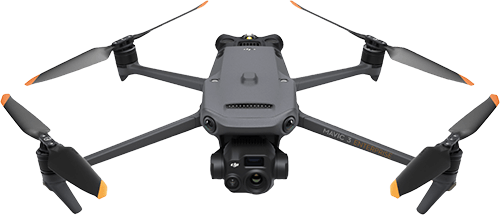
Mavic 3M
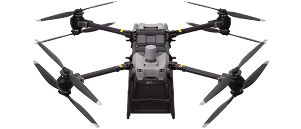
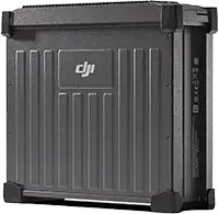
FlyCart 30
Related products
Take a Closer
Look
Look
Zenmuse S1
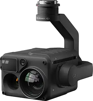
Zenmuse H20N
Zenmuse H20T
Zenmuse V1
Mavic 3T
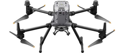
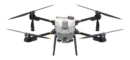
Matrice 350 RTK


NEW
NEW
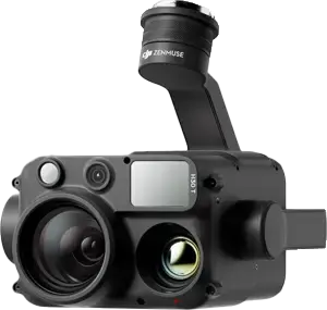
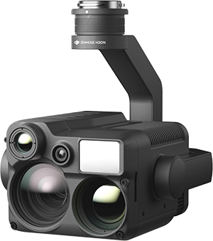
Zenmuse H30 Series
NEW
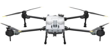
AGRAS T40
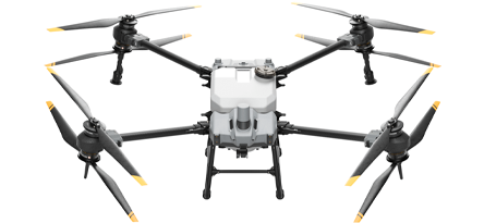
AGRAS T30
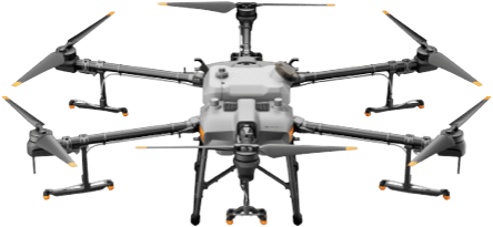
AGRAS T25
AGRAS T20P
AGRAS T10

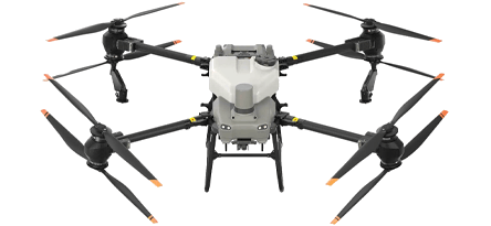
AGRAS T50
TOP
TOP
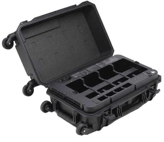
Matrice 350 RTK Charger
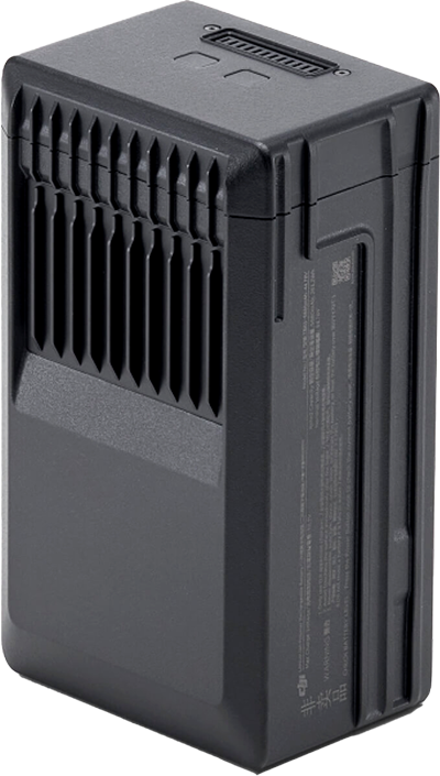
Matrice 350 RTK Battery
Mavic 3E Battery Kit

DB1560 Intelligent Flight Battery
WB37 Intelligent Battery
Trichogramma spreading system
DB2000 Intelligent Flight Battery
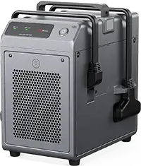
C10000 Intelligent Power Supply
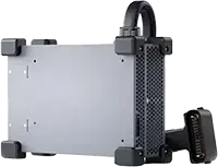
C8000 Intelligent Battery Station
DJI FlyCart 30 Winch System Kit

DJI SMARTFARM WEB
The DJI SmartFarm can instantly generate high-definition images of farmland and orchards, as well as analyze crop growth with total clarity. It enables convenient management of digitalized agricultural information by providing guidance for the automatic operations of different agricultural machinery and monitoring the effectiveness of operations.
Farmland Information Management


Instantly generates HD images of farmland
Automatically identifies farmland borders based on AI to obtain the area of each parcel of field.
Records the operation information of each parcel of field to create farmland management archives.
Intelligent Field Scouting and Analysis
The platform can efficiently conduct field scouting by using aerial survey drones and can analyze the scouting images with AI algorithms. This allows automated monitoring of farmland and crops throughout the plant lifecycle, which significantly optimizes the decision-making process in agriculture.


Checks the terrain height differences of farmland and provides guidance on the level of each parcel of field.
Monitors crop diseases and insect pests in farmland, implementing field scouting that is 100 times more efficient than conventional methods.
Monitors crop growth to promptly discover differences in growth and enable targeted remedies.
Variable-Rate Operations Guidance
The platform can detect growth differences based on the NDVI (normalized difference vegetation index), generate prescription maps, and synchronize them to agricultural drones to implement variable operations, saving pesticides and fertilizer.


3D Route Generation
The platform can generate 3D maps for hillside orchards with complex terrains and can plan 3D routes with height information to provide optimal routes for agricultural drones, improving the efficiency and safety of hillside orchard operations.
In 2021, a precision solution with variable input rates successfully increased the yield of an experimental cotton field, covering an area of 330 hectares, owned by the agricultural cooperative Xufeng, by 10%, reaching 9.15 kg/ha.
Boost Yield on a Large Scale
Cotton in Western China
In the Southern Jiangxi Province of China, Mr Liu Yanghai previously needed to hire ten workers for two days to spray 150 mu (24.7 acres) of orchard. Now, he can finish spraying within 3.5 hours by using DJI T40 and the 3D routes for fruit trees.
Reduce Manual Labor
Orchard in Southern Jiangxi
In 2022, the variable fertilization solution for rice enabled rice producers in Japan to reduce the amount of chemical fertilizer by 11% while increasing production by 9%. The solution solved various problems, such as excessive fertilization in particular areas, delayed maturity, and lodging.
Increase Yield with Less Fertilizer
Rice in Japan
Released by DJI Agriculture’s partner in Hungary, PlantaDrone used Multispectral Drone to monitor farmland before and after sowing, separated the emergence locations of Cirsium arvense based on NDVI, and generated a precision spraying prescription map. The map was then uploaded to the drone for spraying. This way, the drone successfully conducted precision weeding, which reduced both herbicide use and costs.
Enhance Precision While Reducing Cost
Weeding in Hungary
Case Studies
Supported Devices


© 2023-2026, SYSTEMEX Sp. z o.o. - all rights reserved
SYSTEMEX Sp. z o.o.
ul. Grzybowska 80/82/700
00-844 Warszawa, Polska / Poland
ul. Grzybowska 80/82/700
00-844 Warszawa, Polska / Poland
NIP / VAT ID PL5273062037,
KRS: 0001042475
KRS: 0001042475
+48 694 694 843
info@systemex.pl