
Crop Protection
Efficient & Autonomous Operation
Land Surveying
Payloads
Detect Every Detail

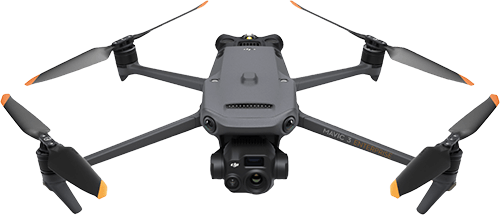
Mavic 3M
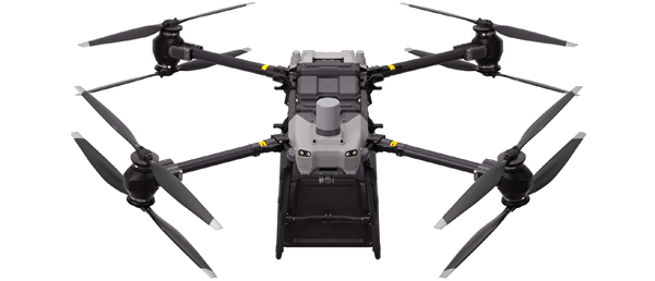
FlyCart 30
Related products
Take a Closer
Look
Look
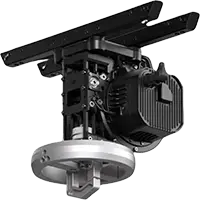
Zenmuse S1
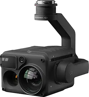
Zenmuse H20N
Zenmuse H20T
Zenmuse V1
Mavic 3T
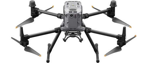
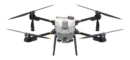
Matrice 350 RTK


NEW
NEW
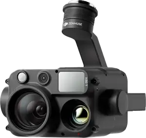
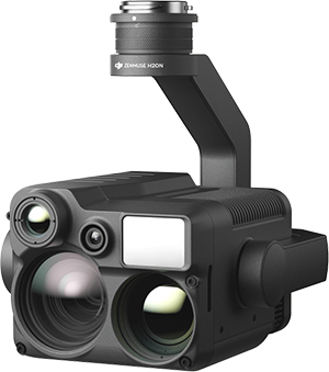
Zenmuse H30 Series
NEW
AGRAS T40
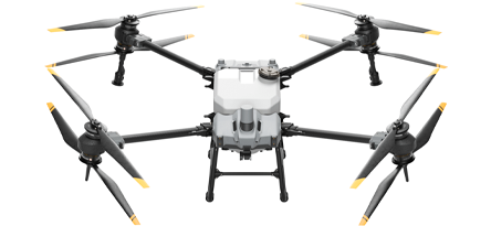
AGRAS T30
AGRAS T25
AGRAS T20P
AGRAS T10

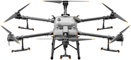
AGRAS T50
TOP
TOP
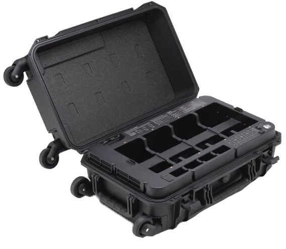
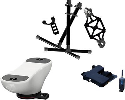
Matrice 350 RTK Charger
Matrice 350 RTK Battery
Mavic 3E Battery Kit

DB1560 Intelligent Flight Battery
WB37 Intelligent Battery
Trichogramma spreading system
DB2000 Intelligent Flight Battery
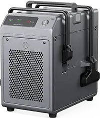
C10000 Intelligent Power Supply
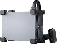
C8000 Intelligent Battery Station
DJI FlyCart 30 Winch System Kit

FAQ
Maximum flight altitude: 100 m (subject to local regulations, please check with your local dealer);
Longest control range: 2,000 m; Maximum flight speed 10 m/s, maximum operating flight speed 10 m/s.
Longest control range: 2,000 m; Maximum flight speed 10 m/s, maximum operating flight speed 10 m/s.

Droplet size: 50-500 μm.
The droplet size can be customized or set to one of six droplet size levels: Very Coarse, Coarse, Medium, Fine, Very Fine, and Extremely Fine.
The droplet size can be customized or set to one of six droplet size levels: Very Coarse, Coarse, Medium, Fine, Very Fine, and Extremely Fine.
No.
1. Multidirectional Obstacle Sensing on the horizontal plane as well as Obstacle Bypassing in the direction of the drone's nose.
2. Steep-slope Terrain Follow.
2. Steep-slope Terrain Follow.
1. These features can be used in AB flight routes and fully automatic operations, but not in manual routes.
2. The light intensity must be moderate, the scenarios must have rich texture features, and the Binocular Vision System must be free of stains or obstructions.
3. Active Obstacle Bypassing is supported at an altitude of 2.5-8 m. Terrain Follow is supported at an altitude of 1.5-30 m.
4. Obstacle Bypassing is not recommended around electric or guy wires.
It can survey slopes up to 20°.
*To ensure a high success rate of surveying and mapping, T25 will automatically adjust its flight speed based on the hill slope. The steeper the slope, the slower its speed.
*To ensure a high success rate of surveying and mapping, T25 will automatically adjust its flight speed based on the hill slope. The steeper the slope, the slower its speed.
Area Route surveying: Surveys and maps all areas and automatically detects field boundaries and obstacles.Boundary Route surveying: Surveys and maps the 20-m wide area around the field boundary. This mode is capable of quickly surveying large areas and is suitable for areas without obstacles.
Orchard and field routes are compatible with T series Agras drones. Before a mission, check operating parameters such as the field margins, route spacing, and flight speed.
Yes.
No. It is not included as standard.
Yes. The 1.5m-long charging cable of the D12000iEP can be purchased additionally, and used for D6000i.
When conducting fast charging by connecting a third-party generator, please select a generator with 220 V-240 V output and output power no lower than 6 kW. Connect the live wires (labelled with L), null lines (labelled with N), and earth wires (labelled with PE) of the two fast charging cables of the C8000 Smart Charger with the live wire, null line, and earth wire of the generator, respectively.
The T25 Spreading System supports switching to smaller hopper gates. Low flow rate spreading is more precise.
No.
The DJI AGRAS T25 has DJI's new O3 Transmission system equipped with four antennas. It can transmit smoother images when working with tall crops. The video transmission signal quality is greatly improved.
It's an optional module.
T50, T25, T40 and T20P.
1. When using the Relay, make sure there is no obstruction between the remote control and the Relay, or between the Relay and the drone
2. Make sure that the Relay is installed at least 2 meters higher than obstacles to ensure smooth signal transmission.
3. Do not use the Relay during thunderstorms.
2. Make sure that the Relay is installed at least 2 meters higher than obstacles to ensure smooth signal transmission.
3. Do not use the Relay during thunderstorms.
No.
Phantom 4 RTK, Phantom 4 Multispectral, DJI Mavic 3 Multispectral, and DJI Mavic 3 Enterprise are supported. Photos taken by non-DJI aircraft are not supported.
The upload limit for a single mission is 20,000 photos, including TIF format photos. We recommend that you upload no more than 10,000 photos per mission.
Elevation Analysis: Monitor elevation data to analyze land level status and provide guidance on leveling operations to improve efficiency.
Crop growth monitoring: Observe crop growth through NDVI and other vegetation indices to identify seedling emergence, nutritional status, weed distribution, water stress, and other conditions, to improve field scouting efficiency.
Prescription Maps: Generate prescription maps for variable rate fertilization and crop protection based on crop growth monitoring results, ensuring even growth and reducing the application of chemicals.
Fruit tree counting: Automatically count fruit tree numbers.
Surveying and mapping of orchards and farmlands: Map operation areas and plan fully automatic routes for Agras drones.
Farmland surveying and mapping: Generate high-resolution maps where farmland boundaries are automatically extracted, allowing users to survey the cultivated area.
DJI SmartFarm Web is a free trial currently. Follow up for updates.
© 2023-2026, SYSTEMEX Sp. z o.o. - all rights reserved
SYSTEMEX Sp. z o.o.
ul. Grzybowska 80/82/700
00-844 Warszawa, Polska / Poland
ul. Grzybowska 80/82/700
00-844 Warszawa, Polska / Poland
NIP / VAT ID PL5273062037,
KRS: 0001042475
KRS: 0001042475
+48 694 694 843
info@systemex.pl
Your order